
Bukit Tabur Climb
Snippet: Since returning back here in KL, I've been out non-stop around the clock. I need a break to catch my breath.
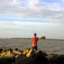
The Bukit Tabur climb was initially planned by Kien Yee & I some two months ago just before we had our break. Bukit Tabur is located in Gombak, near the MRR2 off from Taman Melawati. Relatively unknown except to a few climbers, it is a crystal quartz ridge at the edge of the Klang Gates Dam. (For more info, click here) We needed some adventuring after the aftermath of Templer's Park few months ago and since the holidays were coming to an end, we decided to get on with the plan, and managed to gather another 2 more friends, Alvin d& Vincent Ng. What they didn't know was that it was definitely more challenging than a normal hike around the forest!
We set off in the wee hours of Saturday morning and reached the climbing site at 6am. Although it was our first time there, we had little trouble finding the location thanks to the maps we printed earlier and with GPS. The hard part was finding the starting point of our hike, which was marked just by a stone slab.

Feeling damn semangat eventhough some of them never slept the previous night, we proceeded with our hike into the darkness of the forest, aided by torchlights and a friendly dog. This cute little dog led us along the trail and is known to be the 'guide' here.

The beginning parts of the hike wasn't really tough, but due to the lack of exercise we kinda found ourselves huffing and puffing along the way. So we took it slow, stopping every few moments to admire the scenery, which was slowly turning visible for us.


As the skies start to lighten up, we could see more of our surroundings.


The towering buildings of KL city


The Klang Dam lake surrounded by mist


Alvin and his moment


Carpet moss
We took multiple breaks, usually on the peaks to recharge. Guys camwhoring on top of a hill sound kinda gay huh?


Me scaling this narrow rock wall. I bet my mom would freak out looking at this photo. Haha!

This rock greets you at the top after climbing the wall. =)

We meet different groups of people on the way. Some of them helped each other in navigating the harder parts of the climb.

You can see how treacherous and tiring it was. We had to get down from this peak and climb up the next peak.

Another peak!

Yet another! Betcha wondering how the hell you get over there huh?

A clearer view of the lake...with a group of people trying to climb down on the other side


We set our sights on the east peak in the future!


0 Added Colors:
Post a Comment